📍 Neighborhood News
Fabulous Forties News: Crime Statistics, Safety Data & Breaking News Coverage
By Lance The PI | CA PI License #27617 | Lance The PI News | May 17, 2026
Fabulous Forties News — The Fabulous Forties, or “Fab 40s,” is one of Sacramento’s most iconic and prestigious neighborhoods, located in East Sacramento. Bounded by C Street (McKinley Boulevard) to the north and Folsom Boulevard to the south, and stretching across 40th through 49th Streets, this historic enclave is renowned for its architectural beauty, tree-lined streets, and strong sense of community.
The neighborhood rose to prominence during the 1920s and 1930s, when grand Victorian and early 1900s homes reflected the aspirations of Sacramento’s growing upper class. These homes were considered the suburban mansions of their era and have housed California governors, senators, and notable figures throughout history. President Ronald Reagan lived at 1341 45th Street during most of his term as Governor of California. The area is also famous for its spectacular holiday light displays that draw thousands of visitors from across the region every year.
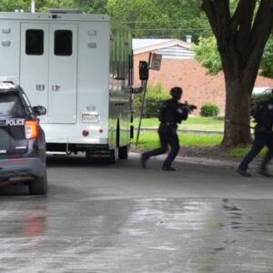
Lance The PI News covers breaking news, crime, and public safety incidents across the Fabulous Forties and greater Sacramento area. Below you will find current crime statistics, incident breakdowns, and a direct link to Sacramento’s official community crime map where you can search by address.
📍 Fabulous Forties — Neighborhood Map
The Fabulous Forties spans 40th through 49th Streets between C Street (McKinley Boulevard) to the north and Folsom Boulevard to the south in East Sacramento.
Map: Fabulous Forties neighborhood, East Sacramento — C Street to Folsom Boulevard, 40th to 49th Streets
📊 Crime Statistics — 95816 Zip Code & Sacramento
The Fabulous Forties falls within the 95816 zip code, which covers the broader East Sacramento area. Here is how crime breaks down for this area and the city overall.
95816 Crime Score
B+
One of the relatively safer zip codes in Sacramento
Sacramento Crime Rate
35/1K
Per 1,000 residents — higher than the national average
Violent Crime Risk
1 in 133
Chance of being a violent crime victim in Sacramento
Property Crime Risk
1 in 36
Chance of being a property crime victim in Sacramento
Vehicle Theft Risk
1 in 158
Chance of having your car stolen in Sacramento
Violent Crime Rate
8.12/1K
Incidents per 1,000 residents — above national median of 4
🔎 Incident Types in the Fabulous Forties Area
Property crime is the dominant category in the 95816 area. Here is a breakdown of the most common incident types reported in and around the Fabulous Forties.
| Incident Type | Category | Notes |
|---|
| Larceny & Theft | Property Crime | Most common incident type. Includes package theft, shoplifting, and items stolen from vehicles. |
| Motor Vehicle Theft | Property Crime | Theft of vehicles or vehicle parts. Residential streets and park areas are common targets. |
| Burglary | Property Crime | Breaking and entering of residential properties. Historic homes in the Fab 40s can be targeted for valuables. |
| Assault | Violent Crime | Incidents involving physical confrontations. Lower rate in this area compared to other Sacramento neighborhoods. |
| Robbery | Violent Crime | Theft involving force or threat. Commercial corridors along Folsom Boulevard see higher activity. |
| Traffic & Auto Accidents | Traffic Incident | Collisions and traffic incidents concentrated on high-volume corridors including Folsom Boulevard and McKinley Boulevard. |
| Vandalism | Property Crime | Graffiti and property damage. Reported periodically throughout the neighborhood. |
| Arson | Property Crime | Least common property crime category in the area. Reported occasionally across Sacramento. |
🗺️ Check Crime Statistics by Address
Sacramento Police Department maintains an official interactive community crime map where you can search any address, intersection, or neighborhood to view reported crimes from the last two or more years. This is the most accurate and up-to-date source for crime data in your specific block.
🔗 Sacramento PD Community Crime Map
Search by address or intersection to view reported incidents in the Fabulous Forties and surrounding East Sacramento neighborhoods. Filter by crime type, date range, and location.
🗺️ Search the Sacramento Crime Map
Data source: Sacramento Police Department Open Data Portal and Sacramento PD Community Crime Map. Statistics reflect 2024 FBI NIBRS data released September 2025.